File size: 16.6 MB
SPCAD an Add-on for Autodesk® AutoCAD® to aid for general workflows of CAD professionals. Equipped with more than 100+ tools, SPCAD promises a comprehensive CAD solution that automates your tasks without compromising accuracy. Specially developed to help run geospatial analysis.
SPCAD is equipped with the necessary tools to make AutoCAD workflows quick, efficient, and convenient. With a wide array of tools and functionalities, SPCAD empowers CAD professionals to seamlessly integrate geospatial data and perform complex tasks without the need to switch between different applications.
Import / Export
Import/Export a diverse range of file formats. e.g. KML, LAS, GPX, geoJSON, and images with world files.
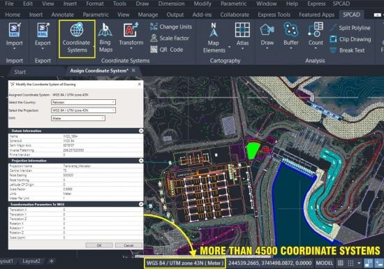
Coordinate Systems
Manage coordinate systems in drawings. Assign and transform into various coordinate systems.
Bing Map
Integrate satellite imagery. Select a coordinate system and a boundary polygon, and retrieve Bing images.
Surface Analysis
Effortlessly analyze surfaces with our CAD app. Use intuitive tools for TIN, contours, and draw profiles.
Map Making
Transform map creation with our CAD app’s efficient tools. Easily add symbols, North arrow, and scale bars.
Cadaster
Effortlessly cut complex or curvy LOTs into parcels and annotate the desired number and area for each.
Atlas
Discover our CAD app’s tools for effortless atlas creation. organize designs into detailed atlases.
Area – Volume
Generate effortless Area Capacity Curves with a TIN and streamline workflows at chosen elevations.
QR Code
Insert location-based QR codes in drawings. Scan with your camera to instantly navigate to Google Maps.
Whats New
Updates: official site does not provide any info about changes in this version
Homepage
https://anonymz.com/…tion.com/spcad/
解压密码:caxfwz
下单请慎重!本站目前只提供软件安装资源,不提供软件安装服务,对软件安装不熟悉者,只能自己通过其他途径解决。


请先 !